Route: Lublin – Nałęczów – Wąwolnica – Kazimierz Dolny (62 kilometers)
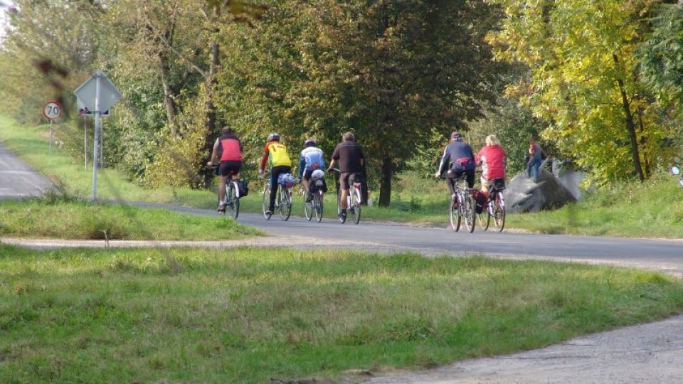
The route leads through the most interesting places and the most known towns of the western Lublin region. It begins in Lublin at the open-air museum of the Lublin Village Museum, then leads through Dąbrowica – the former seat of the famous Firlej family – to Nałęczów – a well-known health resort. From here it runs to Wąwolnica, famous for the cult of the Mother of God Kębelska. Further it leads to Rąblów, in the vicinity of which in May 1944 the troops of the People’s Army and partisans fought a bloody battle with German troops. From Rąblów it runs through the valley of the Witoszyński Stream and Grodarz to the end point of the trail – Kazimierz, the Renaissance pearl of the Vistula. The trail leads along the roads and wilderness of the Nałęczowski Plateau, tops, ravines and valleys of small rivers. From the town of Stanisławka, it already enters the Kazimierski Landscape Park, one of the oldest in Poland. The beauty of the landscape and extremely rich cultural values make it an interesting proposition for those interested in cycling tourism. The length of the trail is 61.4 kilometers. Technically, it has a medium degree of difficulty. It leads mainly on asphalt or concrete roads, only a few short sections have been led along field or forest roads. The trail starts at an altitude of 210 meters above sea level and ends at an altitude of 131 meters above sea level. The highest point on the trail – 245 meters above sea level is located near Motycz. Sections of the trail characterized by steeper descents or climbs are located near the open-air museum, Dąbrowice, Płouszowice, Nowy Gaj, Khruszczów, Rąblów, Kębła and Helenówka.

Bicycle route: Kazimierz Dolny – Józefów on the Vistula – Dzierzkowice – Kraśnik PKP (106 kilometers)
The route leads through the western part of the Lublin Upland. It starts in Kazimierz Dolny – a small town picturesquely situated in the ground-breaking Vistula Valley, with magnificent Renaissance buildings. Then it runs through the Kazimierski Landscape Park. Further through the village of Męćmierz, with interesting wooden buildings, it crosses the Bełżyce Plain, passing the Vistula Gorge from the west of Małopolska. In the town of Dobre, at Skarpa Dobrska, which is a spectacular accent of the Bełżyce Plain, the trail enters the area of the Chodelska Valley. The route leads here over a fairly long section along the Vistula embankment. Then it enters the site of the Hill. It crosses the Wrzelowiec Landscape Park, leading, among others near the recreational lagoon in Kluczkowice. Then it again approaches the Vistula valley in the town of Józefów, which is perfectly visible from the viewpoint near Nietrzeba. The further one leads through the Wyżnica valley, and then Pocztówka, where there are notable towns with pottery traditions – Bęczyn and Urzedów. Then the trail returns to the Wyżnica valley and reaches Kraśnik. The route is 108 km long. Technically, it has a medium degree of difficulty. It mainly runs on asphalt roads.
Bicycle route Lublin – Zawieprzyce – Lake Rogóźno – Lake Piaseczno – Załucze Stare – Urszulin – Wereszczyn – Wojciechów (PPN) – Hańsk – Wola Uhruska (about 110 kilometers)
The route allows you to explore the Łęczyńsko-Włodawskie Lake District – a beautiful land of lakes, swamps and peat bogs, with a huge wealth of flora and fauna. The route of the trail is not difficult, it leads mostly through the plain. The surfaces are varied, but they are mostly asphalt roads. Initially, it runs through the Lublin Upland along the river valleys of Ciemięga, Bystrzyca and Wieprz. Then it leads through the Poleski National Park, the Łęczyńskie Lake District Landscape Park and the Poleski Landscape Park, which constitute the “Western Polesie” International Biosphere Reserve. The route runs near the lakes Nadrybie, Piaseczno, Bikcze and Wereszczyńskie. The final section runs in the border zone between the Łęczyńsko-Włodawskie Lake District and the Chełmskie Hills, through large forest complexes of the Włodawskie and Sobiborskie Forests, and the Bug Valley. In Wola Uhruska, the route reaches the Wola Uhruska – Włodawa cycling route. There are two lookout towers along the route: on Bubnów Swamp (Poleski PN – south-eastern part) and Wola Uhruska. On the trail route, in addition to natural and landscape values, there are also cultural heritage objects. The most interesting of them include the castle and park complexes in Jakubowice Murowane and Zawieprzyce, the historic churches in Bystrzyca and Wereszczyn and the former Orthodox church (currently the church) in Hansk. In Załuczu Stary, the trail runs next to the Didactic and Museum Center of the Poleski National Park.
CENTRAL BICYCLE ROUTE: Kraśnik – Szczebrzeszyn – Zwierzyniec – Górecko Kościelne – Józefów – Susiec – Narol – Hrebenne (about 190 kilometers)
The trail is divided into two stages: Kraśnik – Zwierzyniec and Zwierzyniec – Hrebenne
The first stage of Kraśnik – Zwierzyniec leads through the area of West Roztocze, stretching from Kraśnik to Szczebrzeszyn and Zwierzyniec. This area is covered by a thick layer of loess lying on chalky limestone rocks. There are numerous, 20 meters long and deep gorges, whose slopes are covered with hornbeam. The most effective and picturesque gorge networks occur between Batorz and Turobin and in the so-called Piekiełku between Szczebrzeszyn and Kawęczyn. The highest hill in West Roztocze is 343 meters above sea level (Dąbrowa). Western Roztocze is also characterized by wavy landscapes of arable fields, forming the so-called “checkerboards of fields” with clear copper thresholds to prevent erosion. The diversity and natural richness of these lands resulted in the creation of the Szczebrzeszyn Landscape Park. The length of the first stage of the trail is 100.6 kilometers. Technically, it has a medium degree of difficulty. It leads mostly on asphalt roads. The trail starts at an altitude of 248 meters above sea level. and ends at 230 m a.s.l.
The second stage of the trail from Zwierzyniec to Hrebenne was led through Central and Eastern Roztocze. Central Roztocze – calcareous-sandy with a culmination of 387 m a.s.l. (Wapielnia) stretches between Zwierzyniec and Tomaszów Lubelski. It is a land with an exceptionally varied topography. Chains of limestone hills overgrown with magnificent forests and enclaves of arable fields intertwine with the valleys. A characteristic feature of this region are the numerous inselberg hills. The edge part of the Central Roztocze and the Biłgoraj Plain is extremely attractive. Cascades of waterfalls have formed in the riverbeds of rivers flowing here, commonly known as noise. They are most visible on the rivers Sopot and Tanew. The historic churches, churches, synagogues, stone crosses and roadside figures add extraordinary charm to the lands. In this area, it is best seen that Roztocze is not only a geological boundary between Western and Eastern Europe, but also a borderland of cultures. Numerous monuments and cemeteries reminiscent of the January Uprising, the September 1939 campaign, guerrilla warfare during World War II and the post-war period testify to the turbulent history of this land. The Zwierzyniec – Hrebenne trail is 86 kilometers long. It is mainly run on paved roads but there are also sandy sections.
The article comes from the portal: http://www.turystyka-pojezierze.pl/


